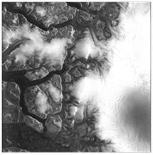
 Scientific articles and news reports have been highlighting for some time the accelerating shrinkage of the Arctic Ice Cap during the summer, as the annual mean extent of ice continues to fall steadily due to warming conditions in the region. Since 1979, the beginning of continuous space-based observations, it has fallen by about 4% per decade, reaching a record low in 2012. Then, ice flows were reduced to just 3.41 million sq. km (1.32 million sq. mi). Although the minimum extent of the ice cap was 50% higher in 2013, it is predicted that larger areas of the Arctic will be navigable during the summer from now on.
Commercial exploitation of the region is also growing, with rapid increases in oil & gas exploration, fishing, and new shipping routes underway. This raises major challenges in monitoring and protecting this pristine area, while enabling sustainable exploitation to take place. In addition to monitoring sea ice, it will also be essential to monitor shipping (to observe both fishing and traffic), detect natural and man-made oil slicks, identify icebergs, and support navigation in the sea ice.
To achieve this over such massive areas, scientists use a type of radar instrumentation flown on satellites known as Synthetic Aperture Radar, or SAR. This uses complex data processing to obtain detailed images of sea ice and the sea surface. The fine resolution of SAR yields exciting views of the two-dimensional ocean surface, its interactions with the atmosphere, long waves, and currents. It can even measure sea ice thickness and detect small leads, enabling ships to be routed through ice-covered regions.

Oil Slick Imaged by SAR

Icebergs Imaged by SAR
© Astrium Geoservices
However, the complex data processing of SAR images is currently carried out on the ground, creating delays in obtaining the images. And bandwidth limitations in data transmission to earth adds a further delay. These and other applications such as offshore engineering and surveillance for disaster monitoring would benefit from the generation of SAR products in real time.
To solve this problem, Astrium Ltd and BAE Systems Advanced Technology Centre have been working together on a CEOI funded initiative to investigate the feasibility of generating real-time SAR images on-board the spacecraft.
The space-borne SAR sensor captures the raw radar echo data (Level 0). The data is then passed through a suitable focussing algorithm to generate the radar images (Level 1). The image data is subsequently made available to the wider user community for higher level processing to generate maps of geophysical features of interest, for example digital elevation maps and ice flow maps.
In all space-borne SAR systems to date the role of the space segment is restricted to capturing the Level 0 data, which is stored in the spacecraft’s mass memory and periodically transmitted to the ground segment for further processing.
By processing the data on-board using space qualified FPGA hardware, the Level 1 product, consisting of detected images and complex, phase preserving products suitable for subsequent interferometric processing, can be downloaded for immediate use. Further, by smoothing the Level 1 product on board, (which involves trading spatial resolution for improved image signal to noise), the volume of image data to be transmitted is reduced considerably compared to the raw echo data. This removes a significant constraint in current systems which are limited by the bandwidth of the downlink transmission system.

Raw data magnitude

Range compressed data

Final processed image
Another feature of this latest FPGA technology is the ability to reprogram devices in flight, in much the same way as software running on a general purpose CPU can be reprogrammed. This opens up the possibility of hardware reconfiguration throughout the mission, even regularly on every orbit in order to change the imaging mode (for example, switching resolutions when imaging over land and imaging over ocean).
This work on SAR on-board processing is only one example of a general trend towards greater on-board processing of raw data acquired by instrument sensors. This is in response to the increasing resolution of modern sensors, at all wavebands, which means that in many cases it is simply impractical to store and forward the raw data to the ground.
In the CEOI work, Astrium Ltd has addressed the problem of mapping SAR focussing algorithms into forms suitable for implementation in space qualified FPGA hardware, and BAE Systems has provided expertise in SAR imagery and quality assessment of test images produced in simulations of the space based processing.
The Centre for Earth Observation Instrumentation (CEOI) is funding a wide range of innovative new instruments that measure our weather, our atmosphere, the icecaps, and many other aspects of the natural environment. Many, like the ‘New On-board Data Processing Techniques for SAR’ are finding fascinating new applications in everyday life.
Further information about this technology and others funded by the CEOI can be found at www.ceoi.ac.uk. You can also contact the CEOI Director, Professor Mick Johnson: Tel: +44 (0)1438 774421 or email: mick.johnson@astrium.eads.net.

