
Between €24m and €116m per annum of economic value generated thanks to the use of satellite radar images
EARSC has published a case report entitled: ‘Copernicus Sentinels’ Products Economic Value: A Case Study of Winter Navigation in the Baltic’.
The report details the economic value generated by the use of satellite imagery in supporting winter navigation in the Baltic Sea. According to the analysis, between €24m and €116m per year of economic value is being generated in Finland and Sweden thanks to the use of these radar images.
It uses a methodology which traces the impact of such usage on the information and services through several steps in the value chain. At each step, the benefits were assessed and the value calculated.
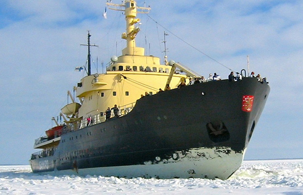
The value-chain analysed starts with the icebreakers that work to keep the Finnish sea lanes and ports open throughout the winter. Finland is 90% dependent on sea transport for its exports and imports and so keeping the factories open and local populations supplied with goods throughout the year has a significant value. Finland has a very close co-operation with Sweden so the study also covers the impact on the Swedish economy.
Finnish and Swedish icebreakers use satellite radar images (which replaced the use of helicopters) to help find the best routes through the ice. Thanks to the wide-area view provided by the satellites, they are able to find better routes through the ice saving time, saving fuel and reducing the uncertainty in the ship arrival times in the ports. This has a positive impact on the various activities downstream and the wider economy.
Download the EARSC Report: HERE