
Specto Natura is part of the team selected by EC DG Environment to monitor Natura 2000 sites using Copernicus products
The Cop4N2K project is led by space4environment of Luxembourg and includes Gisat (CZ), Bilbomatica (ES), Specto Natura (UK) and the Environment Agency of Austria.
The team was awarded a service contract from EC DG Environment to use Copernicus data for monitoring Natura 2000 sites through the creation of a public on-line information system.
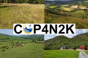 The system will allow a systematic monitoring of pressures that negatively affect the status of species and habitat, in particular for grassland dominated sites.
The resulting service should support EU Member States to take appropriate steps to proactively manage this important network of protected sites and prevent the deterioration of natural species and habitats.
To achieve these aims, current and historical satellite images will be processed and combined with existing Copernicus Land Monitoring Service products to map the status and changes of land cover and land use (LC / LU) in and around each selected Natura 2000 site.
In addition to the core spatial products, several grassland indicators will be developed and a prospective study will define further indicators of grassland intensification and abandonment.
A geospatial database will be developed for storing all products and provide access to all information via an interactive public website.
The project already has a Twitter account (@Cop4N2K) through which the team will announce the launch of the website in the near future, project news and also post relevant grassland related information.
Follow the Twitter account to stay up to date with the team’s activities or contact Geoff Smith of Specto Natura at geoffsmith@specto-natura.co.uk.