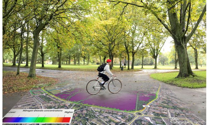
Ordnance Survey and EarthSense Map Clean Air Cycle Routes Gallery Ordnance Survey and EarthSense Map Clean Air Cycle Routes Industry News Ordnance Survey and EarthSense Map Clean Air Cycle Routes BARSCwebAdmin2020-05-20T09:29:02+00:00 Ordnance Survey and EarthSense Map Clean Air Cycle RoutesBARSCwebAdmin2020-05-20T09:29:02+00:00