Skip to content
BARSCwebAdmin2020-05-20T09:28:50+00:00
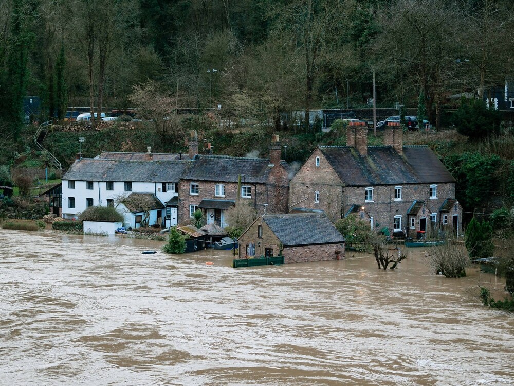
Space Data Can Cut Disaster Response Times, CostsBARSCwebAdmin2020-05-20T09:28:50+00:00
BARSCwebAdmin2020-05-20T09:28:59+00:00
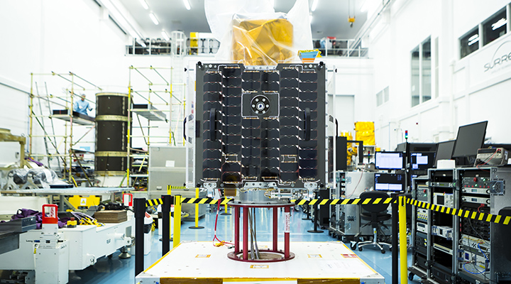
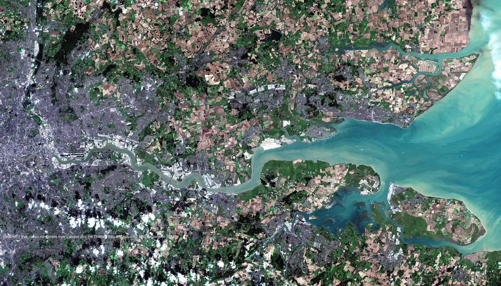
Earth-i chooses Spacemetric to process still images and video from its prototype satelliteBARSCwebAdmin2020-05-20T09:28:59+00:00
BARSCwebAdmin2020-05-20T09:28:59+00:00
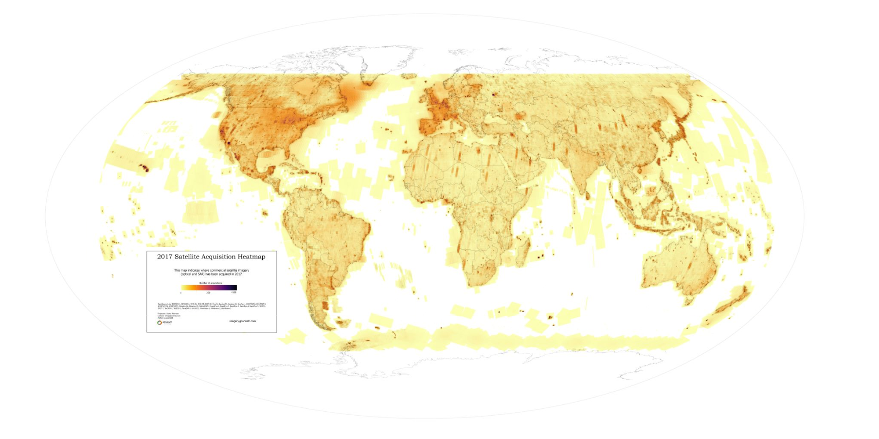
Where are satellites “looking” at our planet? 2017 update from GeocentoBARSCwebAdmin2020-05-20T09:28:59+00:00
BARSCwebAdmin2020-05-20T09:29:00+00:00
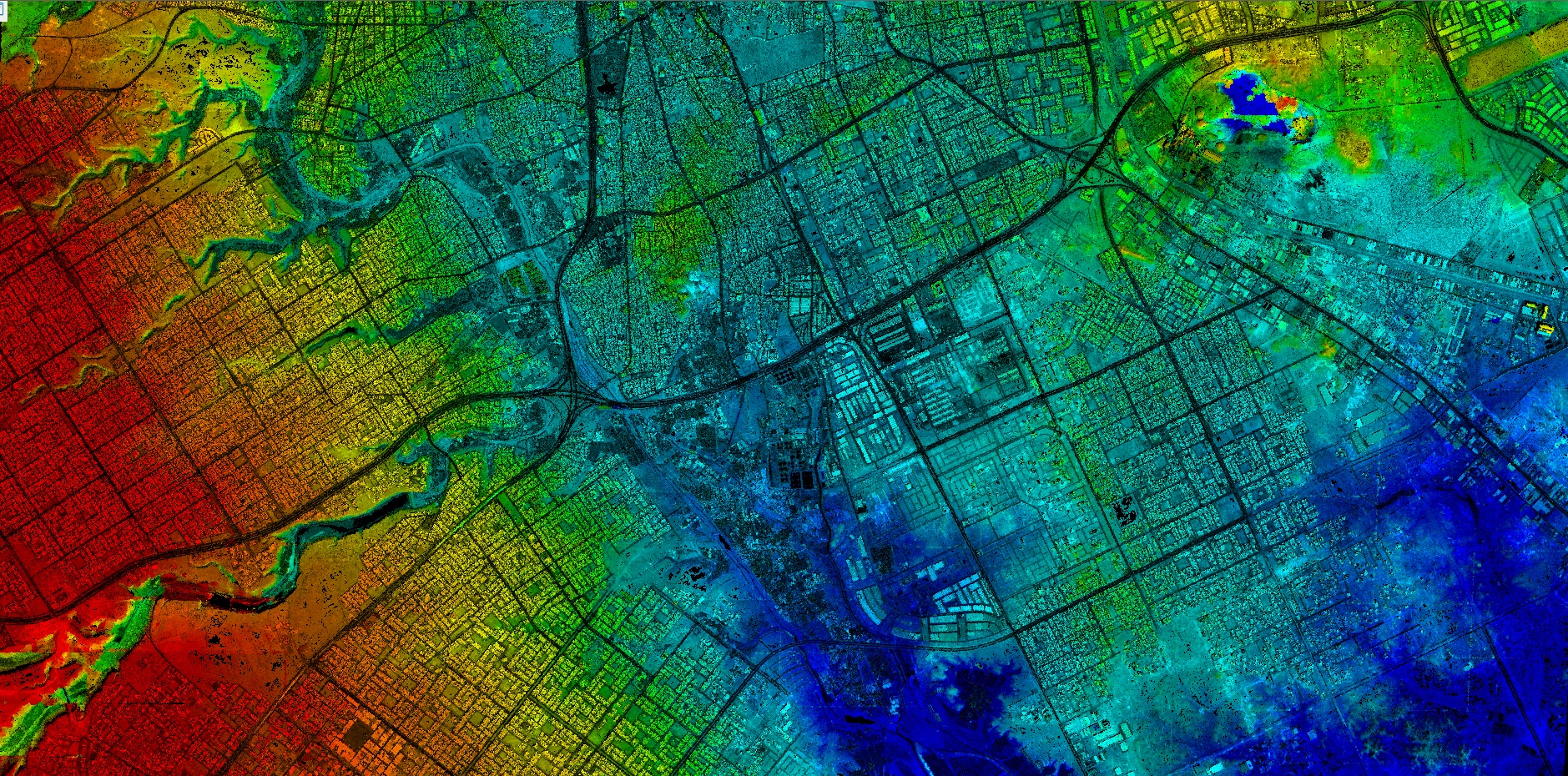
ENVI-powered Urban Heat Island GeoService Available on CloudEOBARSCwebAdmin2020-05-20T09:29:00+00:00
BARSCwebAdmin2020-05-20T09:29:00+00:00
Telespazio VEGA UK sponsors RAeS Commercialisation of Space ConferenceBARSCwebAdmin2020-05-20T09:29:00+00:00
BARSCwebAdmin2020-05-20T09:29:00+00:00
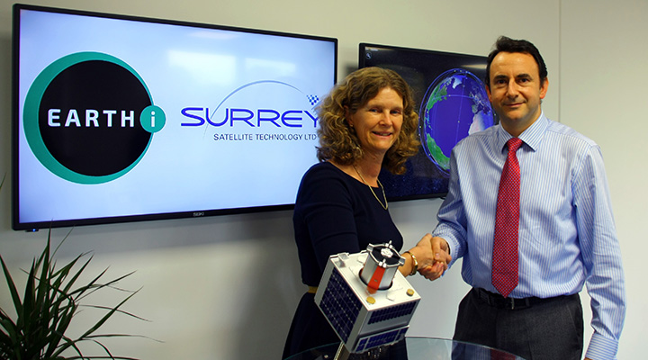
Earth-i Orders Satellites from SSTL for World’s First Full-Colour Video ConstellationBARSCwebAdmin2020-05-20T09:29:00+00:00
BARSCwebAdmin2020-05-20T09:29:01+00:00
The Satellite Applications Catapult Announce December SatuccinoBARSCwebAdmin2020-05-20T09:29:01+00:00
BARSCwebAdmin2020-05-20T09:29:01+00:00
KORE, a new web platform to revolutionise land use, presented at Agritechnica 2017BARSCwebAdmin2020-05-20T09:29:01+00:00
BARSCwebAdmin2020-05-20T09:29:02+00:00
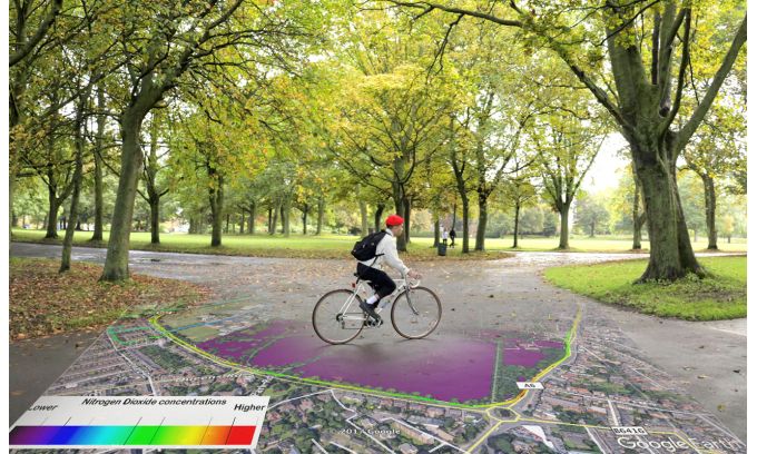
Ordnance Survey and EarthSense Map Clean Air Cycle RoutesBARSCwebAdmin2020-05-20T09:29:02+00:00
BARSCwebAdmin2021-07-28T15:21:58+00:00
GRSG Announces 28th Annual ConferenceBARSCwebAdmin2021-07-28T15:21:58+00:00
Page load link